Southern Rockies Western Slope Agriculture (2023 Spring)
Team: Adelaide Gonzalez (Project Lead), Rachel Buchler, Max VanArnam, Stephanie Willsey
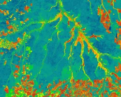
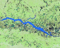
Summary: Over the last decade, the southern Rocky Mountains of the United States have experienced increasingly severe and variable drought. Local ranchers and landowners have reported strain on their operations, citing decreasing forage for their cattle and a need to adjust their business models. The study identified Major Land Resource Area-48 (MLRA-48) and northwestern Colorado as the key region for analysis. NASA DEVELOP partnered with the BLM Colorado River Field Office, Colorado State University Extension, USDA Forest Service, and the National Drought Mitigation Center to address concerns regarding the efficacy of remotely sensed rangeland production platforms and explore possible early warning climatic indicators of drought. The study identified two key platforms, The Rangeland Production Monitoring Service (RPMS) and Rangeland Analysis Platform (RAP), which use NASA Landsat 5 Thematic Mapper (TM), Landsat 7 Enhanced Thematic Mapper Plus (ETM+), Landsat 8 Operational Land Imager (OLI) to estimate rangeland biomass. We regressed these with in situ biomass data to validate their efficacy and found that RAP was more effective than RPMS in estimating rangeland biomass, though it presents a tendency to overestimate. Our study performed a random forest analysis, comparing monthly RAP biomass estimates to a variety of climate variables, including mean precipitation, temperature, Palmer Drought Severity Index, snow water equivalent, wind speed and direction, and vapor pressure deficit. We determined that vapor pressure deficit minimum and precipitation are key indicators in predicting forage production in MLRA-48. Our climate analysis provided our partners with greater understanding of the influence of various climate variables in determining rangeland production and allows them to assist land managers in drought mitigation.


