Description
This three-part introductory training will cover a number of topics relating to landslides, demonstrating a wide variety of NASA Earth science data uses to characterize landslides and their impacts. The training will provide the scientific background of landslides to answer important questions such as: What is a landslide? Where do they occur? What causes them, and why?
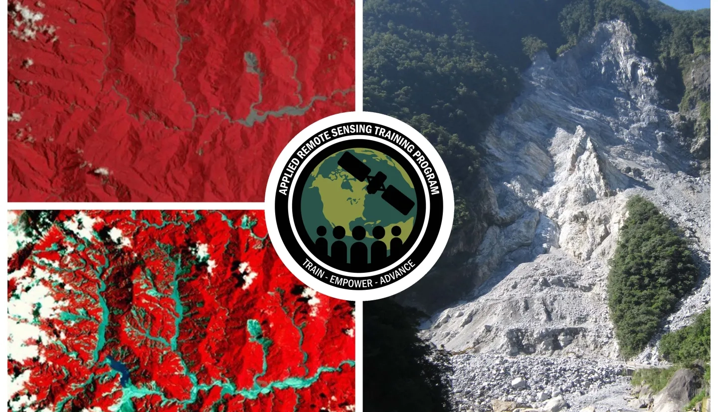
Participants will learn how satellite-based Earth observations can inform landslide science and disaster planning with a focus on key observations and model data, including optical and synthetic aperture radar (SAR) based analysis. The training will include how NASA data and models can be used to automate landslide detection to rapidly map where landslides have occurred post-disaster using the NASA SALaD model (Semi-Automatic Landslide Detection). The training will also cover how satellite-based Earth observations can better predict the location and timing of landslides using the global LHASA model (Landslide Hazard Assessment model for Situational Awareness). These open source tools can help communities prepare for and respond to landslides all over the world.
By the end of this training attendees will be able to:
- Identify the core concepts of landslide risk mapping including geophysical and meteorological drivers, and how satellite data can be used for this purpose.
- Select appropriate satellite data and model data to support landslide science and disaster preparedness associated with landslides.
- Recognize how to map where landslides have occurred using optical data and understand how automated tools can be used for this purpose.
Primary target audience: Remote sensing scientists and geospatial analysts from local, regional, federal, and non-governmental organizations to use remote sensing for landslide monitoring and risk assessment.
Secondary target audience: Academics and researchers interested in remote sensing of natural hazards.
Other potential participants: Any practitioners of remote sensing data
- Three, 90 minute sessions
- Includes a 30 minute Q&A
ARSET Host: Sean McCartney
Guest Instructors: Robert Emberson
- About ARSET
- Core concepts
- Satellite observations of landslides
- Ancillary data
- Optional independent activity
Materials:
ARSET Host: Sean McCartney
Guest Speakers: Robert Emberson, Pukar Amatya
- Landslide mapping using satellite data
- Automated mapping
- Non-optical detection
- Optional independent activity
Materials:
ARSET Host: Sean McCartney
Guest Instructors: Robert Emberson
- Landslide susceptibility
- Constructing susceptibility models
- Dynamic hazard models
Materials:
- Presentation Slides
- Q&A Transcript
- Homework (Due April 01, 2025)