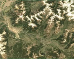
This proposal represents a collaborative multi-agency effort to improve decision-making on management of the Appalachian National Scenic Trail (A.T.) by providing a coherent framework for data integration, status report and trend analysis. The A.T. is 2,175 miles long and crosses 14 states while intersecting 8 National Forests of the USDA Forest Service (FS), 6 units of the National Park System (NPS), more than 70 State Park, Forest, and Game Management units, and 287 local jurisdictions. The A.T. and its surrounding 250,000 acres of protected lands harbor forests with some of the greatest biological diversity in the U.S., including rare, threatened, and endangered species, and diverse bird and wildlife habitats; and are the headwaters of important water resources of millions of people. The Trail's north-south alignment represents a cross-section of the eastern United States forests and alpine areas, and offers a perfect setting for collecting scie ntifically valid and relevant data on the health of the ecosystems and the species that inhabit them. The high elevation setting of the A.T. and its protected corridor provide an ideal barometer for early detection of undesirable changes in the natural resources of the eastern United States, from development encroachment to recreational misuse, acid precipitation, invasions of exotic species, and climate change. The project will integrate NASA multiplatform sensor data, NASA's Terrestrial Observation and Prediction System (TOPS) models that is operated at the Ames Research Center, and in situ measurements from A.T. MEGA-Transect partners to address identified national biological diversity priorities of Ecological Forecasting in this solicitation. TOPS is a data and modeling framework that integrates and preprocesses Earth Observing System data so that land surface models, like those to be developed under this project, can be run in near real-time. The urgent need of spatial information for an improved DSS f rom the users' end, the solid foundations that the A.T. MEGA-Transect partners have worked hard to establish, and NASA ESS capacity to contribute to their information needs, all combine to make this a very unique value-added DSS from which the A.T. MEGA-Transect partners and ultimately the American people can benefit. The system will improve the existing decision-making system that exists between the Appalachian Trail Park Office, the Appalachian Trail Conservancy, the NPS Inventory and Monitoring (I) program, and the U.S. Forest Service, and will provide a means to convey meaningful information to the American public. The objectives are to: 1. Develop a comprehensive set of seamless indicator data layers consistent with the Appalachian Trail """"Vital Signs""""; 2. Establish a ground monitoring system to complement TOPS, making to possible to integrate NASA data with in situ observation; 3. Assess historical and current ecosystem conditions and forecast trends by coupling TOPS with habitat models; and 4. Dev elop an Internet-based implementation and dissemination system for data visualization, sharing, and management to facilitate collaboration and promote public understanding of the A.T. environment. To assure the end user's ability to adopt enhancements to the DSS activities, the USGS Eastern Geographic Science Center (EGSC) will work with the USGS National Biological Information Infrastructure (NBII) to conduct usability tests of the A.T. MEGA-Transect-DSS software, assist with engineering the user interface, and serve as a conduit for feedback from users to the backend development team during the initial stages of transition. EGSC will also be available as needs arise in the future for assistance in refining existing functionality or in designing and developing new functionality for the DSS.
Project


