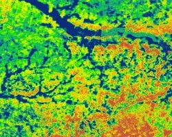
Idaho Wildfires II (Fall 2022)
Team: Talissa Cota (Project Lead), Dana Drinkall, Ryan Healey, Tyler Morvant
Summary: The western United States has experienced twenty years of increased and prolonged drought, which has exacerbated wildfire hazards. These hazards jeopardize population centers through increased risks to ecosystem services, local economies, and livelihoods. The Idaho Office of Emergency Management, Water Resources, and Department of Lands are seeking methods to dynamically monitor these conditions and update models that inform hazard mitigation planning and allocation of management resources. Moving towards this goal, these state agencies partnered with NASA DEVELOP to produce drought-enhanced wildfire hazard models. As the second part of a two-term project, the teams enhanced the state’s current wildfire hazard model with refined data layers and remotely-sensed drought indicators to reflect dynamic ecosystem responses to drought conditions and wildfire potential. The team distinguished between rangeland and forestland ecosystems and investigated relationships between drought metrics and the Normalized Difference Vegetation Index using IDRISI TerrSet Earth Trends Modeler. This analysis determined that total precipitation at a 5-month interval (r2 = 0.72) and the Evaporative Stress Index (r2 = 0.69), and precipitation at a 5-month interval (r2 = 0.42) were essential drivers for vegetation condition in rangeland and forestland, respectively. These variables were incorporated to create a 4-week temporal dynamic model. The team used linear regression to model these enhanced hazard ratings with wildfire frequency and compared them between models. For the case study year 2020, the enhanced model performance (p < 0.10, r2 = 0.01) had less statistical significance than the static model (p < 0.05, r2 = 0.03) but comparably low explanatory power, an indication that further research is required.

