Start Date: April 2, 2025
Disaster Types: Severe Weather, Floods, Landslides
Region: North America
View maps and data on the NASA Disasters Mapping Portal.
UPDATE APRIL 8, 2025
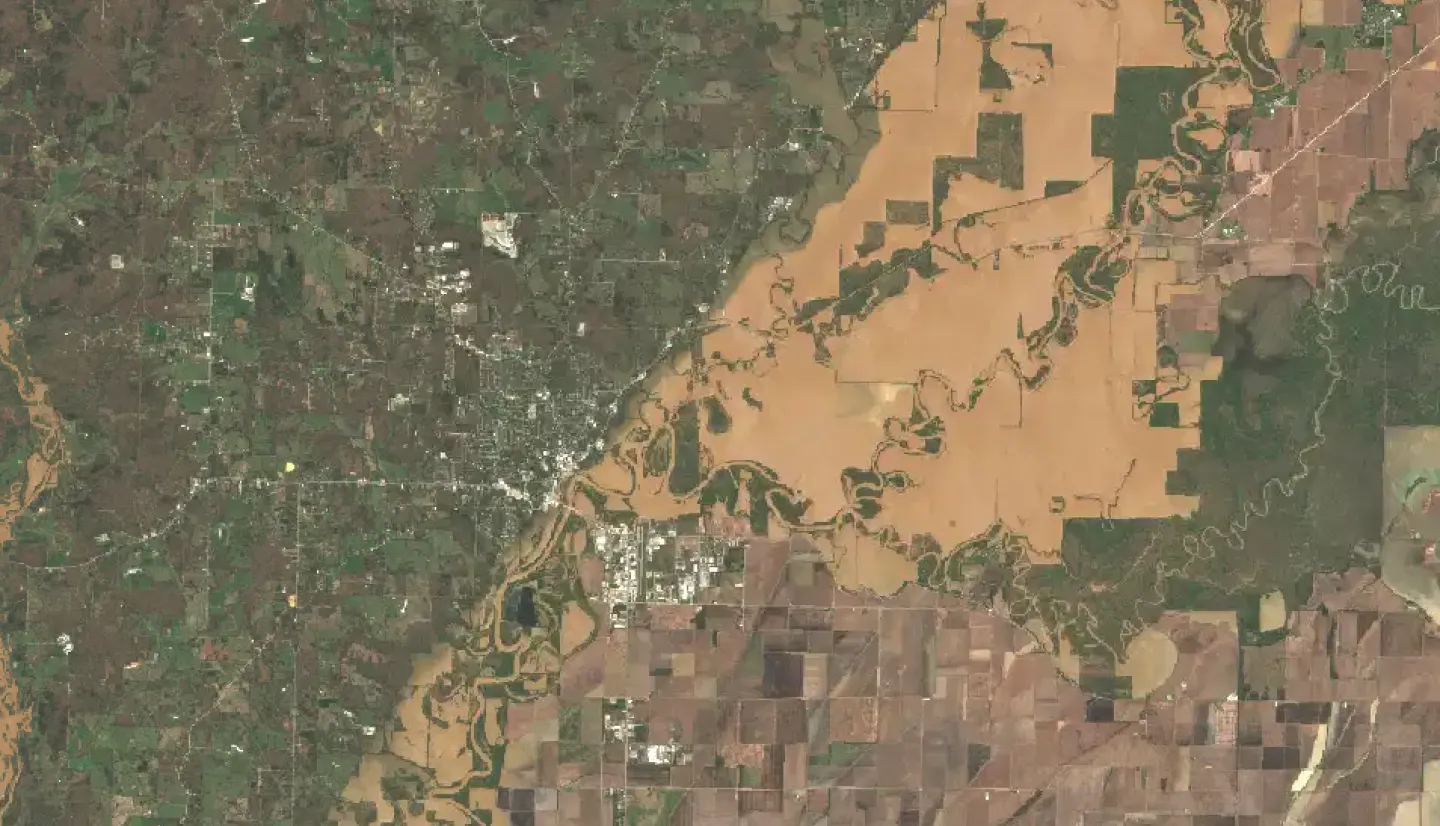
From April 2-6, 2025, severe storms impacted the southern and Midwestern United States, bringing tornadoes and sustained rainfall to at least 10 states. Additional flooding – particularly river flooding – is expected in the coming days. The NASA Disasters Response Coordination System (DRCS) has been activated to support stakeholder requests related to the severe weather and its impacts. Current coordination includes supporting requests from the NWS Southern Region and FEMA Regions 4 and 6, which cover the central southern U.S. and southeastern U.S., respectively.
The DRCS is participating in interagency coordination calls to meet evolving needs, as scientists from multiple NASA centers develop data products related to these storms. These products are intended to improve situational awareness and help identify the location and severity of impacts, such as flooding, potential landslides, and storm-related damage.

Initial products are now available on the NASA Disasters Mapping Portal, with more being added as they become available. Agencies and organizations needing NASA Disasters Program data products to support response or recovery for this event can also email DRCS@nasa.gov with their requests.
LEARN MORE
- Read how NASA-supported researchers are using satellite data to detect atmospheric patterns linked to severe weather to fill gaps in storm damage assessments and support more informed emergency response and recovery efforts.
- Explore NASA automated (“near real-time”) products for floods.
- View an animation of NASA IMERG precipitation rates and totals from the storm system.