Dorian formed as a tropical depression on Saturday, Aug. 24 about 805 miles (1,300 km) east-southeast of Barbados. By 5 p.m. EDT that day, the depression strengthened into a tropical storm and was named Dorian.
On Wednesday, August 28, 2019, the National Hurricane Center or NHC noted that a Hurricane Watch is in effect for Puerto Rico, Vieques, Culebra, and the U.S. Virgin Islands. A Tropical Storm Warning is in effect for the British Virgin Islands and the Dominican Republic from Isla Saona to Samana.
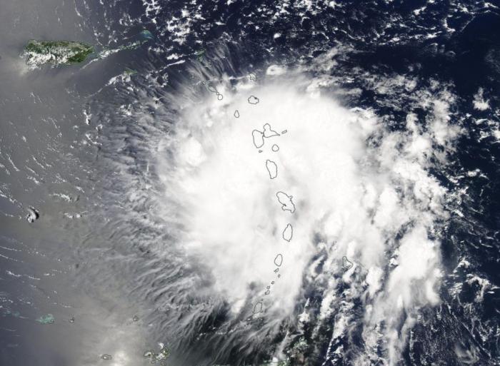
On Aug. 27 at 1:35 p.m. EDT (1735 UTC) the MODIS instrument aboard NASA’s Aqua provided a visible look at Tropical Storm Dorian as it moved over the Leeward Islands. Credit: NASA Worldview, Earth Observing System Data and Information System (EOSDIS)
The Disasters Program has activated with the initial expectation for a Tier I level of effort, and is working with stakeholders from FEMA, the Puerto Rico Science, Technology and Research Trust, and the National Meteorological Office of the Dominican Republic. Anticipated and potentially available products thus far include ARIA Flood Proxy Maps, ARIA Damage Proxy Maps, SPoRT Day/Night Band, SPoRT Land Information System Data, Landslide Nowcast, Water Extent Maps, and GPM Accumulation Data.


