Start Date: March 10, 2026
Type: Floods, Severe Weather
Region: Hawaii, Oceania
View Maps & Data on the NASA Disasters Portal
UPDATE MARCH 25, 2026
A series of consecutive "Kona Low" storm systems has impacted the state of Hawaii, bringing prolonged intense rainfall and severe flash flooding. The extreme weather prompted a Governor's Emergency Proclamation, leading to hundreds of rescues, medical facility closures, and widespread highway disruptions due to debris flows across Honolulu and Maui counties. Communities are facing significant disruptions as officials respond to inundated neighborhoods, manage mandatory evacuations in areas like Waialua and Haleiwa, and actively monitor vulnerable infrastructure.
In response to a request for support from the Hawaii Emergency Management Agency (HIEMA), the NASA Disasters Program’s Disasters Response Coordination System (DRCS) activated March 20 to aid ongoing response efforts.
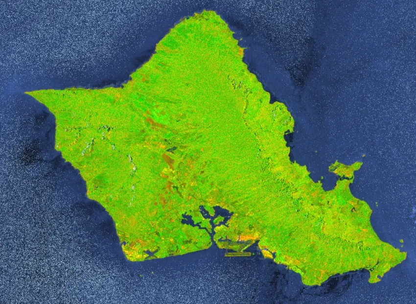
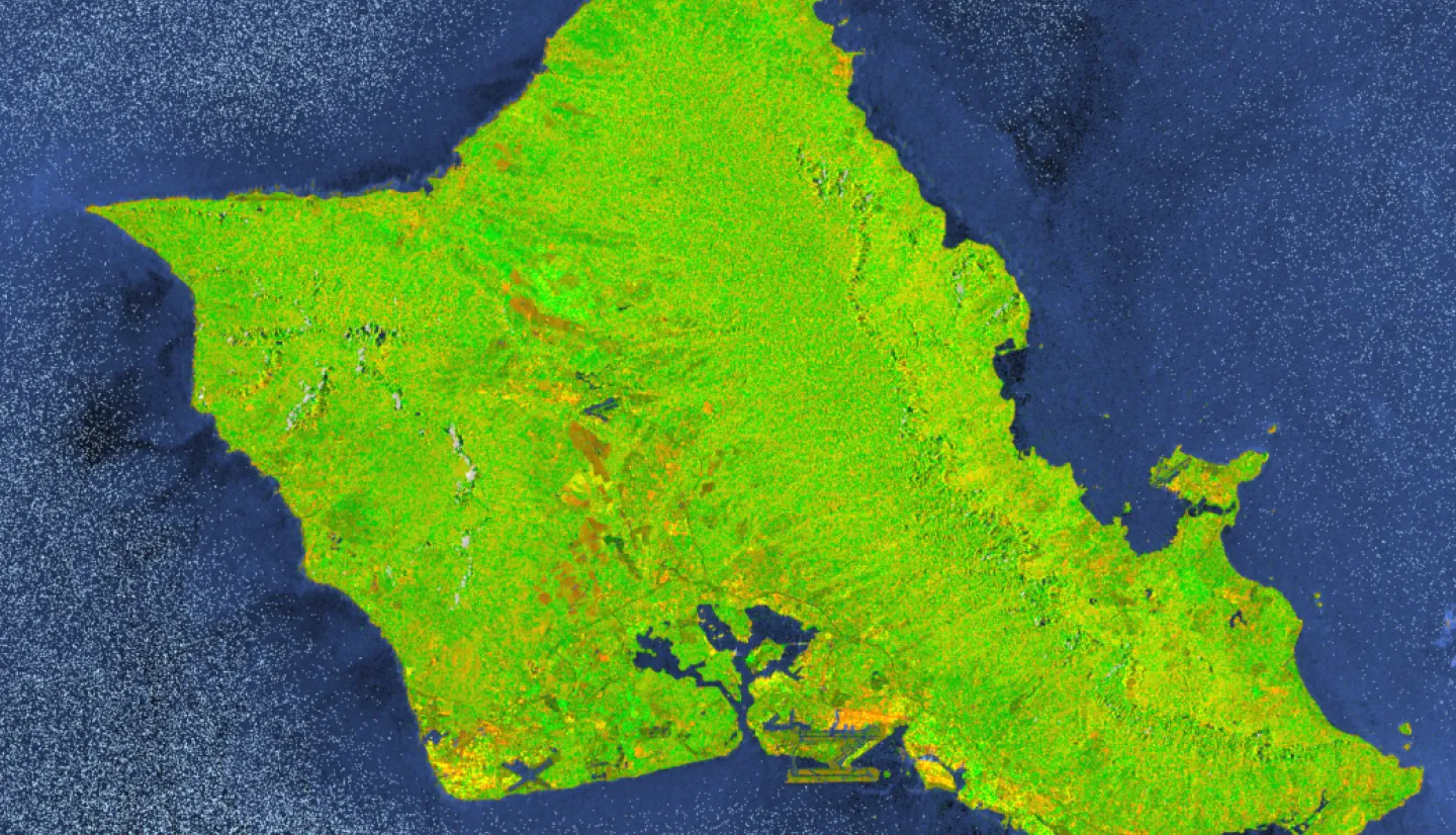
Since persistent cloud coverage has obscured much of the standard optical satellite imagery over the islands, the DRCS team is providing synthetic aperture radar (SAR) products and modeled data. Because SAR sensors can "see through" clouds and capture data day or night, such products may be valuable for helping responders assess flood and landslide extent despite the ongoing severe weather.
To date, the DRCS has published a robust time-series of Copernicus Sentinel-1 SAR RGB imagery spanning before and after the storms (March 10-22) to assess flood impacts, alongside near real-time Landslide Hazard Assessment for Situational Awareness (LHASA) nowcast and exposure maps to evaluate ongoing landslide threats.
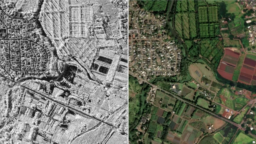
Additionally, NASA leveraged its Commercial Satellite Data Acquisition (CSDA) program to task commercial radar assets, capturing targeted high-resolution backscatter imagery from Capella Space, ICEYE US, and Umbra, including of Waialua and the Wahiawa Reservoir, to help response teams assess critical infrastructure.
The DRCS is actively coordinating with state and federal response partners, including FEMA Region 9 and USGS. Maps and data are being shared to the Hawaii Flood March 2026 event gallery on the NASA Disasters Portal as they become available.
Read more about this event and view additional imagery via NASA's Earth Observatory.