Date
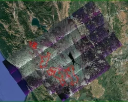
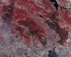
Wildfires began burning in numerous counties across the entire state of California on October 9th. These fires have prompted mass evacuations, over 190,000 acres and 1,500 structures have been burned. Key infrastructure is threatened as strong winds continue to fuel the fast moving fires. As many as 18 fires have burned in nine counties, and an estimated 20,000 people have been evacuated.
- RECOVER Fire Maps:
- Clear Lake: https://recover2.giscenter.isu.edu/ClearLakeFire_CA
- Grass Valley: https://recover2.giscenter.isu.edu/GrassValleyFire_CA
- Mendocino Complex: https://recover2.giscenter.isu.edu/MendocinoComplexFire_CA
- Adobe: https://recover.giscenter.isu.edu/AdobeFire_CA/
- Atlas: https://recover.giscenter.isu.edu/AtlasFire_CA/
- Pocket: https://recover.giscenter.isu.edu/PocketFire_CA/
- Tubbs: https://recover.giscenter.isu.edu/TubbsFire_CA/
- Understanding Post-fire Mapping
Resources:
List of Resources: https://disasters.nasa.gov/news/california-wildfire-resources


