Incorporating Our Data Into Your Work
Discover resources you can use that take advantage of NASA's vast and robust record of historical data, and discover innovative platforms that feature near real-time data that can increase your understanding of our planet and its changing conditions right now.
We’re always looking for ways to improve our offerings and make it easier for you to apply Earth observing data to the problems you face. Contact us and let us know how we can help.
Jump to a Section:
- Disasters Mapping Portal
- Disasters Community Newsletter
- Disasters Training
- Data & Tools
- Black Marble
- code.nasa.gov
- Crisis Mapping Toolkit
- Earthdata Search
- Earthdata Pathfinders & Data Toolkits
- EOSDIS Distributed Active Archive Centers (DAACS)
- GPM Precipitation and Applications Viewer
- LANDSLIDES@NASA
- NASA Worldview
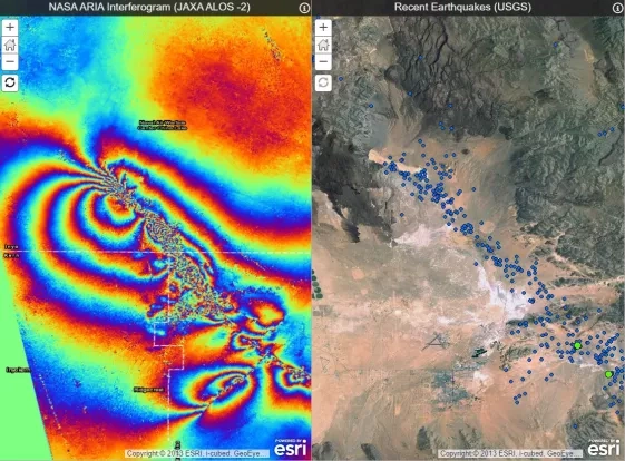
- NASA Worldwind: Quake-hunter
- RECOVER DSS (Recovery Decision Support System)
- Synthetic Aperture Radar (SAR) Resources
Disasters Mapping Portal
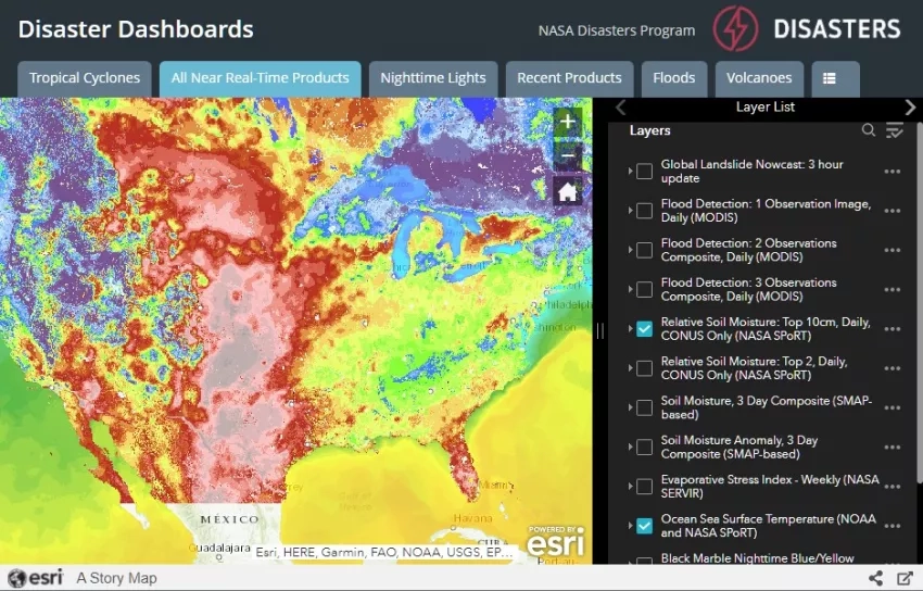
The NASA Disasters Mapping Portal is a powerful Esri-based online interface for viewing, analyzing, and downloading the latest near real-time and disaster specific products in Geographic Information Systems (GIS) format. Products are available as REST and open-source compatible WMS endpoints. They are freely available for anyone to use and there are no login requirements.
Visit the NASA Disasters Mapping Portal - maps.disasters.nasa.gov
Portal Resources:
-
NASA Disasters Mapping Portal Data Publication Guide - Version 1.1, Jan. 25th, 2019
-
NASA Disasters Mapping Portal Product Guide 2019 - Version 1.1, Sept. 22nd, 2021
Disasters Community Newsletter
The information that NASA provides through data portals, dashboards and visualizations empowers decision-makers to understand the connections and interplay between Earth phenomena. With the NASA Disasters Community Newsletter, we’ll connect you with people enabling action, innovative technologies, cutting-edge research, and ways to access geospatial information that can help your community throughout every phase of the disaster cycle.
Sign up for the NASA Disasters Community Newsletter
Past Editions:
DISASTERS TRAINING
ARSET provides in-person and online trainings focusing on access and applications of remote sensing observations for disaster management. The trainings are aimed at facilitating disaster monitoring, preparedness, and relief activities by using remote sensing observations. Topics can include extreme rainfall, floods, landslides, hurricanes, earthquakes, and oil slicks.
Courses are appropriate for policy makers, regulatory agencies, NGOs, and other applied science professionals.
Data & Tools
For disaster response teams, near-real-time data can be instrumental in decision-making. NASA’s Earth-observing satellites, ground data and airborne science missions offer unique insight — and best of all, it's all free to use. Learn about the datasets, models and tools that can aid your community.
Black Marble
NASA’s Black Marble products show human-generated lights at night on Earth's surface from space, enabling wide range of applications for a broad spectrum of data users. The data are generated using the day night band (DNB) of the Visible Infrared Imaging Radiometer Suite (VIIRS) instrument aboard Suomi National Polar-orbiting Partnership (NPP) satellite.
Along with their primary purpose of supporting the short-term weather prediction and disaster response communities, they also provide new data for tracking wildfires, gas flares, and light pollution, and have numerous socioeconomic uses, such as proxying economic activity, monitoring changes in energy infrastructure in urban areas, and providing a data to humanitarian organizations in conflict areas. For example, the Black Marble product can be used to compare city lights before and after a hurricane strikes, showing which areas may be affected by power outages or damaged infrastructure.
Learn more:
- Black Marble homepage
- VIIRS Land Black Marble product info
- ARSET Training - Introduction to NASA’s "Black Marble" Night Lights Data
code.nasa.gov
Search for open source software and code released by NASA projects.
Crisis Mapping Toolkit
The Crisis Mapping Toolkit is a collection of algorithms and utilities for creating maps in response to crisis. The CMT relies on Google Earth Engine (EE) for much of its data processing. The CMT is released under the Apache 2 license.
The CMT is developed by the NASA Ames Intelligent Robotics Group, with generous support from the Google Crisis Response Team and the Google Earth Engine Team.
The CMT currently provides:
- Algorithms to determine flood extent from MODIS data, such as multiple thresholding techniques, learned approaches, Dynamic Nearest Neighbor Search, and more.
- Algorithms to determine flood extent from SAR data, such as histogram thresholding and active contour.
- Algorithms to detect water and clouds in LANDSAT images.
- Various helpful utilities, such as:
- An improved visualization UI, with a drop down menu of layers similar to the EE javascript playground.
- Local EE image download and processing, for the occasional operation that cannot be done efficiently in EE.
- A configurable domain specification to define problem domains and data sources in XML.
- Functions for searching image catalogs.
NASA EarthData Resources
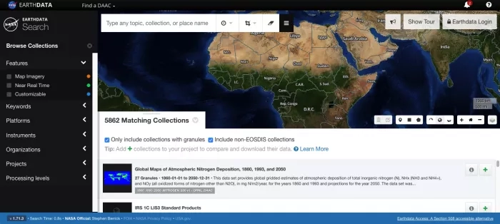
This application allows you to search, discover, visualize, refine, and access NASA Earth Observation data.
Earthdata Disasters Pathfinders & Data Toolkits
New to using NASA Earth science data? These pathfinders are designed to help guide you through the process of selecting data products and learning how to use them.
Data pathfinders provide direct links to commonly-used datasets across NASA’s Earth science data collections. Earthdata search provides direct access to datasets, regardless of where they are archived, providing access to all research quality data for a given measurement type. These pathfinders supplement the search capability by providing datasets through commonly used tools; these tools provide different ways of visualizing the data, options for subsetting the data, and options for saving the data in different file formats.
Pathfinder Topics:
- Cyclones
- Earthquakes and Volcanoes
- Landslides
- COVID-19
- Geographic Information Systems (GIS) Data Pathfinder
- Getting Started with Synthetic Aperture Radar (SAR)
NASA's remote sensing data help scientists, researchers, decision makers, and more understand the contributing forces and the impacts of catastrophic events. NASA also provides near real-time (NRT) data for time critical applications.
Data Toolkits:
EOSDIS Distributed Active Archive Centers (DAACs)
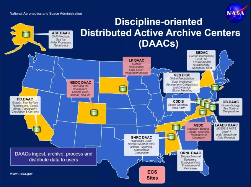
Earth Observing System Data and Information System (EOSDIS) is designed as a distributed system, with major facilities at Distributed Active Archive Centers (DAACs) located throughout the United States. These institutions are custodians of EOS mission data and ensure that data will be easily accessible to users. The EOSDIS DAACs process, archive, document, and distribute data from NASA's past and current Earth-observing satellites and field measurement programs. Acting in concert, the DAACs provide reliable, robust services to users whose needs may cross the traditional boundaries of a science discipline, while continuing to support the particular needs of users within the discipline communities. User services include:
- Assistance in selecting and obtaining data
- Access to data-handling and visualization tools
- Notification of data-related news
- Technical support and referrals
The EOSDIS Earthdata Forum provides a central, online location where data users can interact with subject matter experts from NASA’s Distributed Active Archive Centers (DAACs) to discuss data applications and research needs, and get answers to specific questions about accessing, viewing, and manipulating NASA Earth observation data. Click here to visit the forum.
GPM Precipitation and Applications Viewer
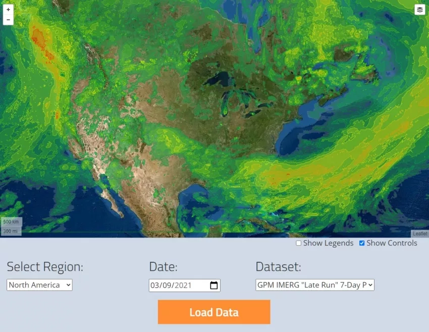
View, analyze and download the latest near-realtime precipitation data and landslide hazard data from NASA's Global Precipitation Measurement Mission. Use the Javascript-based API to automatically download datasets and build your own precipitation mapping apps.
LANDSLIDES @ NASA
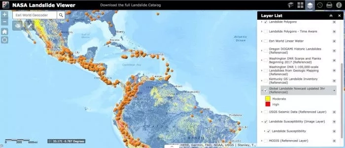
Landslides cause billions of dollars in infrastructural damage and thousands of deaths every year around the world.
However, to date we do not have a global picture of exactly where and when landslides occur owing to their small size and difficulty in identifying their onset and extent when no one is around to witness their impacts. The COOLR project seeks to cultivate an open platform where scientists and citizen scientists around the world can share landslide reports to guide awareness of landslide hazards for improving scientific modeling and emergency response.
The Cooperative Open Online Landslide Repository (COOLR) is a worldwide database of landslide events. It currently includes NASA’s Global Landslide Catalog (GLC) and landslide events contributed by citizen scientists. In a future release of COOLR, collated landslide inventories will be added by REST API or manually.
NASA Worldview
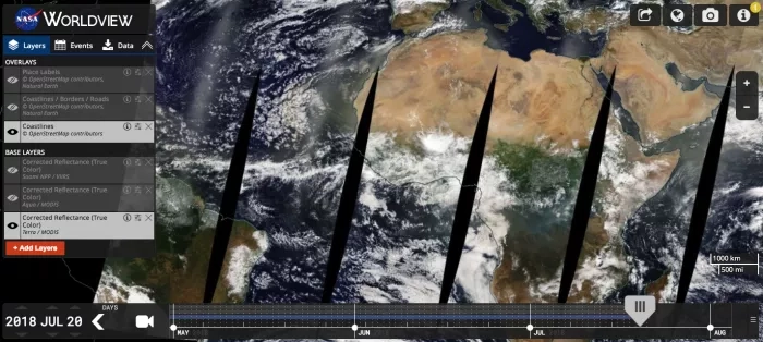
This app from NASA's EOSDIS provides the capability to interactively browse over 600 global, full-resolution satellite imagery layers and then download the underlying data. Many of the available imagery layers are updated within three hours of observation, essentially showing the entire Earth as it looks "right now". This supports time-critical application areas such as wildfire management, air quality measurements, and flood monitoring. Arctic and Antarctic views of several products are also available for a "full globe" perspective. Browsing on tablet and smartphone devices is generally supported for mobile access to the imagery.
Worldview uses the Global Imagery Browse Services (GIBS) to rapidly retrieve its imagery for an interactive browsing experience. While Worldview uses OpenLayers as its mapping library, GIBS imagery can also be accessed from Google Earth, NASA World Wind, and several other clients. We encourage interested developers to build their own clients or integrate NASA imagery into their existing ones using these services.
NASA WorldWind: Quake-hunter
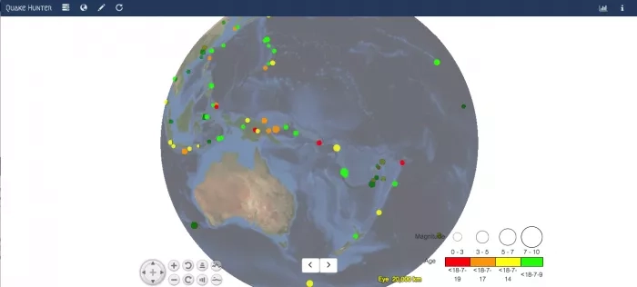
Quake Hunter is a valuable tool for understanding how tectonic plates interact with one another. Quake Hunter visualizes any range of earthquake data from the USGS, in 3D, either on the whole planet or in a user-defined geographically constrained area. With powerful querying tools, this application provides exactly what the user wants to see in terms of earthquake event data around the world.
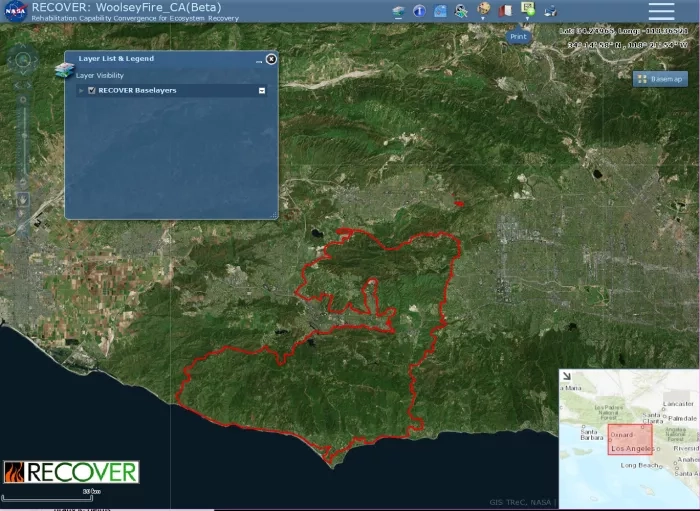
RECOVER DSS (Recovery Decision Support System)
Username: recoverdss
Password: MWay7!XW
RECOVER is a decision support system funded by NASA Applied Sciences with a GIS-based web map interface designed to enable fire managers to develop better informed post-fire rehabilitation plans. RECOVER is continuously compiling a database of current and authoritative geospatial data (land cover, natural resources, transportation, etc.) for the entire Western United States. The web map client was developed to allow partners to view and query these layers with nothing more than a desktop web browser.
To access the RECOVER DSS or if you would like to see additional data layers made available in RECOVER, please contact Keith Weber at webekeit@isu.edu
Synthetic Aperture Radar (SAR) Resources
sAR Handbook
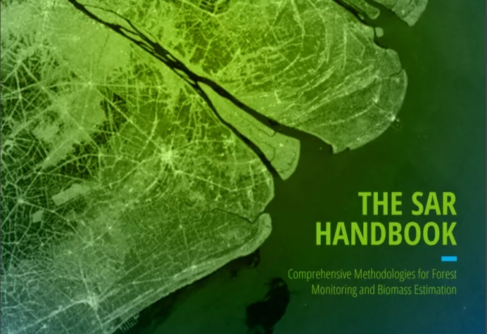
"The SAR Handbook: Comprehensive Methodologies for Forest Monitoring and Biomass Estimation" is the culmination of a two-year collaboration between NASA SERVIR and SilvaCarbon. Five trainings, led by six SAR subject matter experts, were held at hubs throughout the SERVIR network. The topics of these trainings included SAR basics, SAR for forest change detection, forest height estimation, biomass estimation, mangrove monitoring, and sampling design. Each of these training topics are covered in a SAR Handbook chapter, which includes the theoretical basics and applied exercises. You can download the entire SAR Handbook (PDF) below, or explore individual chapters, trainings and one-pagers.
This interactive story map from the Alaska Satellite Facility shows you how to search for and submit data for processing, explores the InSAR product package, and demonstrates techniques for interacting with and interpreting the data.
Near Real-time (NRT) data from ESA Sentinel Satellites
This document provides information on how to access near real-time data from European Space Agency (ESA) Sentinel satellite instruments, which can be used for a broad range of Earth science applications.