From Virginia to the Caribbean, NASA’s Disasters Program and its partners are developing cutting-edge tools to help communities withstand the growing impacts of hurricanes, floods, and other hazards. Here, explore three "Disasters Science to Action” projects that are turning advanced Earth science into actionable strategies that strengthen resilience before disaster strikes. Harnessing satellite observations, historical data, and predictive models, scientists are partnering with local public and private sector stakeholders to provide clearer insight into disaster risk and co-develop tools to plan, adapt, and mitigate. Together, these projects show how Earth observations can move beyond research to directly support decision-making, helping vulnerable regions build long-term disaster resilience.

Earth Science Tools to Safeguard Coastal Cities from Rising Waters
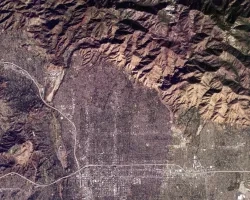
The Hampton Roads region of Virginia faces serious risks from rising water levels, frequent flooding, and increasingly intense hurricanes and coastal storms. Local leaders need better tools to understand where flooding will occur, how to protect vulnerable communities, and how to enhance stormwater management systems before the next major storm hits. To address these threats, NASA’s Risk Analysis Science Innovators workgroup is working with Old Dominion University, the Virginia Institute of Marine Science, the Hampton Roads Planning District Commission, and the cities of Hampton, Norfolk, and Virginia Beach. Together, they are using satellite data, historical storm reconstructions, and advanced models to assess flood risks and co-develop practical, locally relevant solutions. A key part of the project is a new geo-visualization and information hub, which will integrate near real-time Earth observation data, predictive flood modeling, and social vulnerability indicators into a user-friendly dashboard. This resource will help city leaders prioritize infrastructure upgrades, optimize stormwater management, and guide future land use and emergency planning based on site-specific risks. While centered on Hampton Roads, this project is also designed to serve as a national model for using NASA Earth science to help coastal and flood-prone cities reduce disaster risk, strengthen hurricane preparedness, and build long-term resilience.

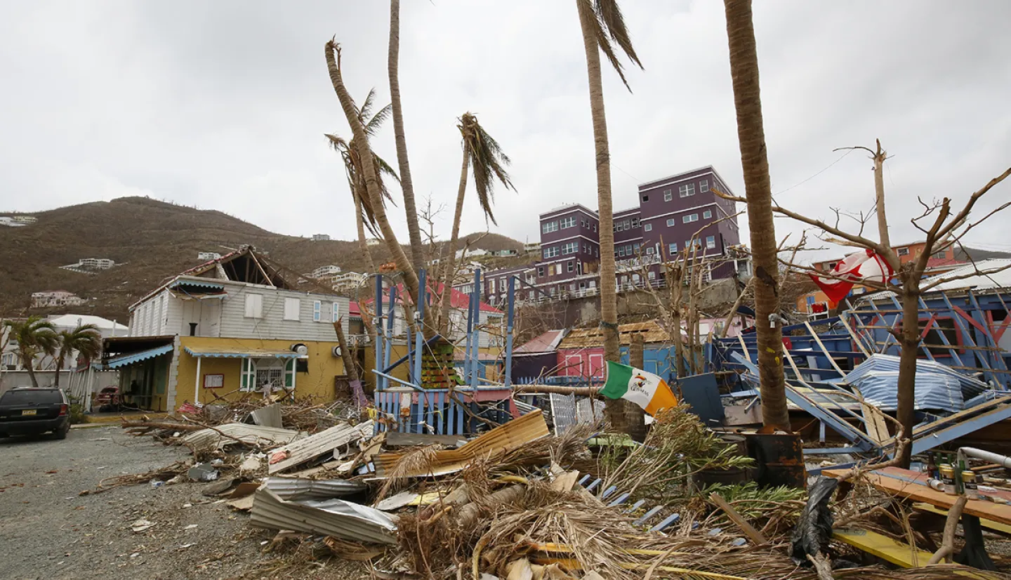
Strengthening Resilience in the Caribbean with Data Driven Insights
The GEDI-Resilience Navigator project, led by Charles Huyck of ImageCat, is developing a new framework to help communities better prepare for and recover from disasters. While the technology can be used to address impacts of both earthquakes and hurricanes, the initial focus focuses of the project is on the Caribbean – a region that is frequently in the path of strong tropical weather. By combining Earth observation data, local infrastructure development patterns, and socioeconomic information the framework can be used to estimate potential losses in not just lives and dollars, but also in the time needed for communities to recover. What sets this effort apart is its integration of local knowledge and collaboration with local decision-makers to ensure that results can be directly applied to real-world planning and investments. Although initial applications are focused within the Caribbean, the framework is intentionally designed to be scalable and transferable. The insights gained through this project will support more targeted, data-informed disaster risk reduction strategies for coastal and island regions vulnerable to hurricanes as it contributes to the NASA Disasters program’s broader goal of delivering actionable science to reduce risk and build resilience where it is needed most.
Developing Frameworks to Guide Disasters Decision Making
Dr. Danielle Wood, founding director of the Space Enabled Research Group at MIT Media Lab, is leading a project called, “Integrated Systems Modeling to Support the Use of Earth Observations in the Disaster Management Lifecycle.” Working collaboratively with other funded Disasters program investigators, the team is using systems-thinking approaches – including Wood’s original EVDT (Environment-Vulnerability-Decision-Technology) framework – to develop unified decision frameworks for the use of Earth observation data for disaster professionals. By combining environmental data with insights into vulnerability and decision-making, the project aims to enable a more integrated approach to managing disaster risk. One example is a prototype system designed to help planners in hurricane prone regions identify who is most at risk, what interventions are most effective, and when they should be implemented. The Integrated Systems Modeling project includes training sessions and collaborative workshops to help NASA scientists apply these tools across different hazards and communities, and the Disasters program is currently implementing these systems thinking approaches into the development of NASA’s upcoming Disasters Partnership and Learning Platform (DPLP). By improving how such systems are built and who they serve, the work is helping NASA and its partners turn complex science into practical insights that support communities before, during, and after disasters strike.