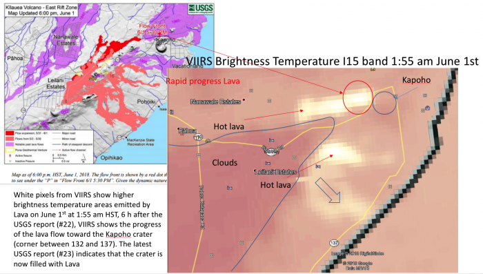
The movement of the recent Lava channel from fissure 8 is now reaching far east near the Kapoho crater. on June 1st at 1:55 am (HST), A band of enhanced radiance from the I15 VIIRS channel was consistent with USGS thermal imagery. It shows the rapid progress of the lava front toward the Kapoho crater 6 hours after the USGS Thermal map and indicates that the Lava intersected road 132 leaving the communities of Vacationland and Kapoho Beach Lots without road access.
USGS also reported significant convective clouds near the Leilani area which were thought to be influenced by hot lava creating convective instability through Pyroconvection. This is very interesting since it may provide a transport pathway for air enriched with SO2, sulfate and burning materials to reach the upper troposphere.


