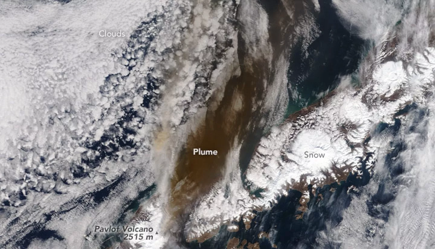
In late March 2016, Pavlof volcano on the Alaskan Peninsula began erupting again for the first time since November 2014. Alaska’s most active volcano has erupted six times since 1996 and 21 times in the past 50 years.
According to the Alaska Volcano Observatory, this eruption was the most energetic since 1996. It sent ash and gas as high as 11 kilometers (37,000 feet) above sea level, causing the cancellation of several dozen flights in the region. Volcanic ash can pose significant hazards to airplanes as the fine, glassy particles can scour windows and clog or stall jet engines.
Pavlof was most active on March 27–28, but then seismic activity and emissions waned through the rest of the week. Reports from nearby scientific and coast guard observers suggest that the eruption produced volcanic mud flows and lava flows. Ash fell on Alaskan villages to the northeast, including Nelson Lagoon, where residents reported a coating of as much as two-thirds of an inch (1.7 centimeters).
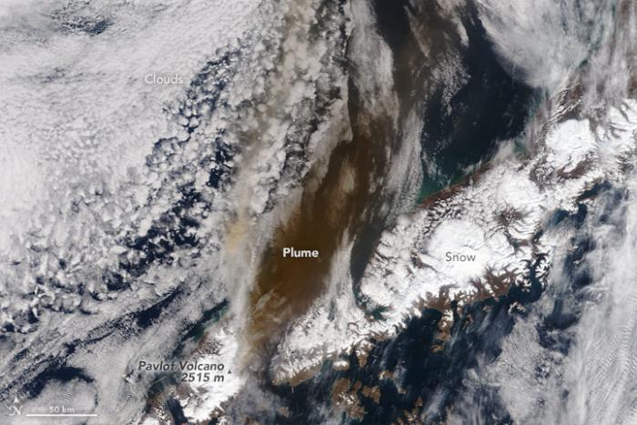
The Moderate Resolution Imaging Spectroradiometer (MODIS) instruments on NASA’s Terra and Aqua satellites acquired images of the ash plume at 11:45 a.m. Alaska time (21:45 Universal Time) and 1:35 p.m. (23:35) on March 28, 2016. By March 31, the volcano was still emitting some ash and gas, though the plume did not rise higher than 2.5 kilometers (8,000 feet).
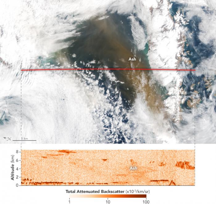
Other NASA sensors also observed Pavlof’s emissions. The Cloud-Aerosol Lidar and Infrared Pathfinder Satellite Observation (CALIPSO) satellite flew over the plume about 40 minutes after the Aqua satellite on March 28. The satellite has a lidar instrument, CALIOP, which uses laser pulses to create a profile of clouds and particles in the atmosphere. The instrument detected ash between 3 and 6 kilometers in altitude at the time of the March 28 overpass. Such observations can help researchers improve forecasting models and issue more accurate warnings to pilots.
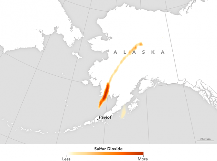
On the same day, the Atmospheric Infrared Sounder (AIRS) on Aqua detected the sulfur dioxide emissions from the eruption. Sulfur dioxide, or SO2, is a colorless, pungent gas that can be both an air pollutant and important atmospheric component, depending on where it resides. Along with water vapor and carbon dioxide, sulfur dioxide is one of the most abundant gas emissions during volcanic eruptions.
References
- Alaska Dispatch News (2016, March 30) Ash from Pavlof Volcano coated village, drifted into interior Alaska.Accessed April 1, 2016.
- Alaska Volcano Observatory (2016) Pavlof. Accessed April 1, 2016.
- Eruptions Blog, via Wired (2016, March 29) Alaska’s Volcano Cools Down, While a Chilean One Heats Up. Accessed April 1, 2016.
- Eruptions Blog, via Wired (2016, March 28) Pavlof’s Unexpected Eruption in Alaska Spews Ash 20,000 Feet High. Accessed April 1, 2016.


