A collaboration by Peru, NASA and the US Agency for International Development (USAID)
Now possible is a way to monitor Amazonia gold mining activity and deforestation in near real-time using satellite-based Earth observations, due to project supported by the government of Peru, NASA and the United States Agency for International Development (USAID).
Sandra Cauffman, the deputy director of NASA's Earth Science Division, joined other dignitaries at a June event announcing the effort. The lead developer of the service is the Peruvian non-profit group Conservación Amazónica (ACCA).
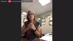
NASA's Sandra Cauffman joined the June 19, 2021 Spanish-language event announcing the new gold mining tracking tool. Cauffman's comments occur at ~23 minutes into the event. Credits: Amazon Conservation
"This project would not have been possible without experts from across South America, satellite data from our European colleagues, and knowledge sharing from similar efforts in West Africa," Cauffman said in an accompanying NASA.gov feature.
In West Africa, a similar SERVIR project is ongoing and there was a sharing of knowledge, and building on work done to monitor gold mining and deforestation by the SERVIR-West Africa hub.
SERVIR is a joint initiative between NASA and USAID designed to increase environmental resilience and decision-making worldwide. Through its network of regional hubs, SERVIR works with local decision makers to solve issues by using publicly available satellite imagery, geospatial data, and analysis tools.
More details available at the NASA.gov feature: Teaming up to Track Illegal Amazon Gold Mines in Peru


