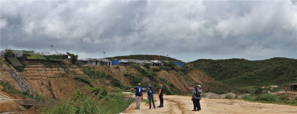
Since August 2017, more than 740,000 Rohingya refugees have fled to Bangladesh, most eventually settling in camps in the hilly terrain in the southeastern part of the country. In the summer monsoon season, increased rainfall means the camps are especially vulnerable to flooding and landslides, made worse as rapid deforestation removes the plants that help keep soil in place. To reduce the risk of disaster, decision-makers are now incorporating NASA Earth observations to inform where to build refugee camps – and which areas may be too unstable to even store supplies.
NASA’s Applied Sciences Disasters Program and Columbia University’s International Research Institute for Climate and Society (IRI) are working with humanitarian partners to co-design a process for integrating humanitarian considerations into the development of NASA satellite data products and analyses. To that point, Shanna McClain, NASA’s lead for Risk Reduction and Resilience in the Disasters Program; Robert Emberson, a NASA Postdoctoral Program fellow at NASA's Goddard Space Flight Center; Andrew Kruczkiewicz, senior research associate with IRI; and Geneva List, senior assistant researcher from IRI; recently co-led a workshop with the United Nations Development Programme (UNDP) in Cox’s Bazar, Bangladesh to work with these partners to identify opportunities for integrating NASA modeling and data into their decision-making process.
During the August 2019 workshop, NASA researchers also learned more about what products and formats could be most useful for local partners on-site. Now, camp managers have access to near real-time NASA data on land use, rainfall and elevation from NASA’s Global Precipitation Measurement (GPM) mission and Moderate Resolution Imaging Spectroradiometer (MODIS) instruments on the Terra and Aqua satellites. This is part of a new approach to improve integration of the needs of users into the early stages of developing data products for humanitarian actors.
The team is sharing information with UNDP, the International Organization for Migration (IOM), the United Nations High Commission for Refugees (UNHCR), and the Bangladesh government through the Connecting Earth Observations to Decision Makers for Preparedness Actions (COMPAS) project. They are also continuing to incorporate feedback to customize the products NASA provides, to support the highly localized decisions made by humanitarian professionals working in the camps.


