UPDATE 9/27/18:
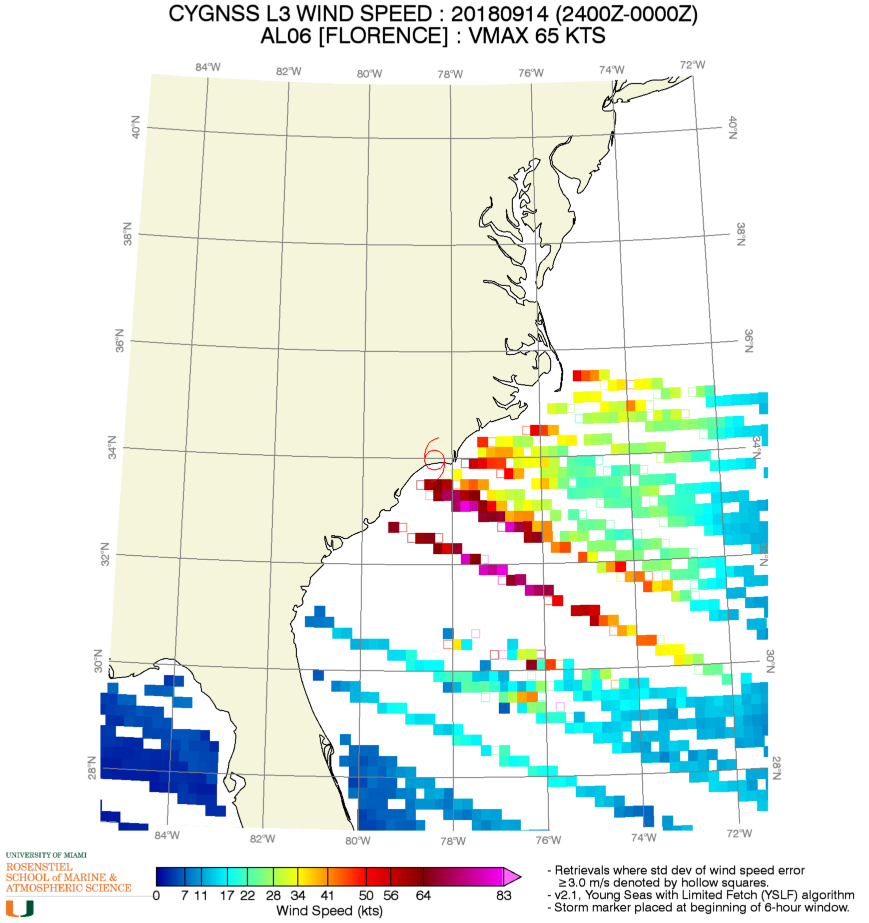
CYGNSS Ocean Windspeed data from Hurricane Florence is available to view on the University of Miama Rosentiel School of Marine & Atmospheric Science website: http://andrew.rsmas.miami.edu/bmcnoldy/cygnss/?d=20180914
UPDATE 9/17/18:
All eight CYGNSS observatories have been continuously operating in science mode since Hurricane Florence transitioned from a tropical storm to a Cat1 hurricane on 9 Sep 2018. Examples of ocean surface winds measured during overpasses on 10 and 11 Sep are shown below. These winds are derived from the standard (compressed DDM) data which are measured continuously. Higher resolution data-taking modes (Full DDM and Raw IF) have been commanded whenever the observatories are over Florence.
About CYGNSS
The CYGNSS satellite system is able to measure ocean surface wind speed in all precipitating conditions, including those experienced in the Tropical Cyclone (TC) eyewall. CYGNSS measures ocean surface wind speed in the TC inner core with sufficient frequency to resolve genesis and rapid intensification processes. This study will focus to understand the coupling between ocean surface properties, moist atmospheric thermodynamics, radiation, and convective dynamics in the inner core of a TC. CYGNSS can see through clouds and map inundation at ~15km resolution.
Learn more about CYGNSS: http://dme.engin.umich.edu/CYGNSS/


