Share icon
Published
Image of NASA's color coded SAR based flood detection maps reveal extensive flooding in areas of Vietnam.
Acquired Nov. 11. 2017

NASA color coded SAR based flood detection maps reveal extensive flooding in areas of Vietnam. The SAR data used in analysis are Copernicus Sentinel data (2017), processed by ESA. In the figures, the blue tones represent flooding due to Typhoon Damrey while the black color represents water covered areas before the typhoon. Other colors indicate mostly land.
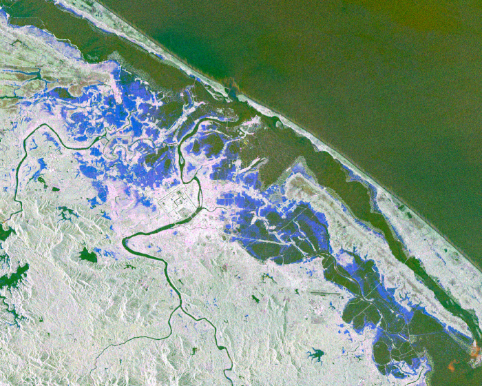
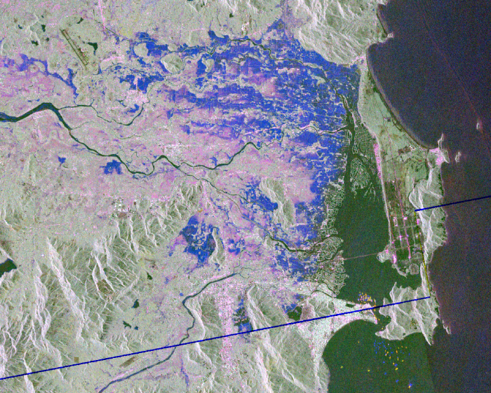
Images of NASA's color coded SAR based flood detection maps reveal extensive flooding in areas of Vietnam.
Acquired Nov, 11 2017


Related Impact

Story
By:
Laura Guzmán, NASA Lifelines
Story
By:
Biplov Bhandari
Chinmay Deval
Manish Shrestha
News
By:
Jacob Reed, NASA Disasters