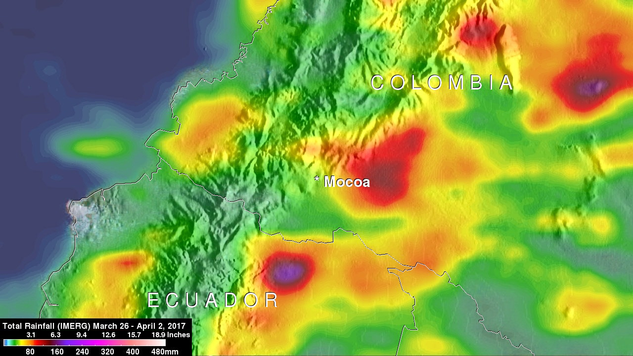
Click here to view animated GIF
Late Friday night and Saturday morning flash flooding and mudslides killed over 250 people in Mocoa, Colombia. Extremely intense storms added heavy rain to water logged terrain around Mocoa. Water from this heavy rainfall converged into a river that runs close to Mocoa causing it to overflow it's banks with deadly results.
Integrated Multi-satellitE Retrievals (IMERG) data were used to estimate the amount of rain that fell near Mocoa, Colombia during the seven day period from March 26 to April 2, 2017. IMERG indicates that area rainfall totals during the week were frequently greater than 80 mm (3.1 inches). This analysis also shows the locations of heavy rainfall that extended from east of Mocoa into the high mountains that surround the city. Torrents of water rushed from the high terrain and were funneled into the valley where Mocoa is located. IMERG rainfall totals have been adjusted to reflect observed values in other similar extreme rainfall events.


