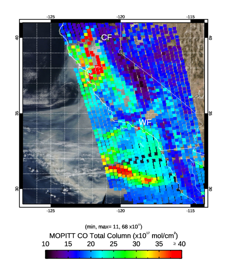
The Measurement of Pollution in the Troposphere (MOPITT) instrument is flying on board NASA's Terra satellite. It observes Carbon Monoxide (CO) in the troposphere through thermal and near infrared channels. This product was created by the MOPITT Near-Real Time system on Saturday November 10, 2018 and submitted to NASA Worldview. The images clearly show enhanced levels of carbon monoxide associated with the Camp and Woolsey wildfires in northern and southern California. The high levels of carbon monoxide west of Mexico may be an aged part of the Woolsey / Camp fire plumes, based on the location of high carbon monoxide the day before and on the smoke trajectories shown by the Moderate Resolution Imaging Spectroradiometer (MODIS) visible images.
For more information please visit: https://www2.acom.ucar.edu/mopitt
To access this data please visit: https://eosweb.larc.nasa.gov/project/mopitt/mopitt_table and https://earthdata.nasa.gov/earth-observation-data/near-real-time/downlo….


