Description
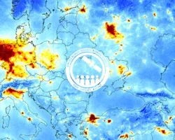
This training is tailored to those interested in learning how to access and visualize NASA satellite imagery. With the world’s eyes and media coverage turned to recent global changes in air pollution, this two-part webinar series provides a primer for the novice and a good refresher course for all others. Participants will learn which pollutants can be measured from space, how satellites make these measurements, the do’s and don’ts of interpreting satellite data, and how to download and create your own visualizations.
By the end of this training, attendees will be able to:
- List the pollutants that can be observed by NASA satellites
- Find and download imagery for NO2 and aerosols/particles
- Describe the capabilities and limitations of NASA NO2 and aerosol measurements
Members of the public, journalists, meteorologists, and others new to remote sensing.
- What is NO2?
- NASA Remote Sensing Basics
- Interpreting NO2 Imagery: Dos and Don'ts
- Downloading Data and Creating Imagery
Materials:
- What are Aerosols?
- Interpreting Aerosol Imagery: Dos and Don'ts
- A Tour of NASA Resources for Generating Your Own Visualizations
Materials:


